
🏖️ Marco Island Weekly Beach Conditions
Sunday, September 13 – Saturday, September 19, 2026
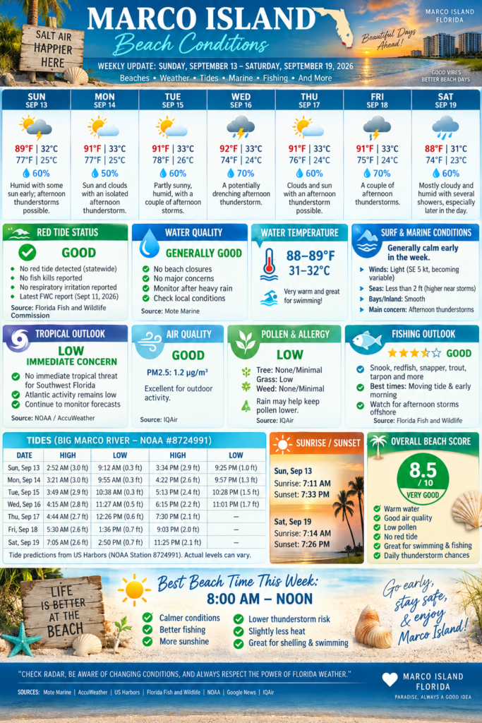
Marco Island begins the week with warm Gulf water, generally calm seas, no current statewide red-tide detection, and very warm, humid weather. The main beach-day issue this week will be the familiar Southwest Florida pattern of afternoon showers and thunderstorms, especially from Sunday through Friday.
Overall, mornings should offer the best windows for swimming, shelling, fishing and boating before thunderstorms become more numerous later in the day.
🦠 RED TIDE STATUS: 🟢 GOOD
Excellent news for Marco Island beachgoers.
The Florida Fish and Wildlife Conservation Commission reported on September 11 that the Florida red-tide organism, Karenia brevis, was not observed in samples collected statewide during the previous week. No red-tide-related fish kills or respiratory irritation were reported statewide during that period.
Recent Collier County monitoring also reported South Marco Beach at “not present” levels, with no red-tide-related respiratory irritation or fish kills reported.
🟢 Marco Island Red Tide Rating: EXCELLENT
🐟 Fish kills: None reported
😮💨 Respiratory irritation: None reported
🌊 Karenia brevis: Not detected statewide in the latest weekly report
Mote Marine recommends checking its Beach Conditions Reporting System for very localized conditions before heading out because beach observations can change quickly.
💧 WATER QUALITY: 🟢 GENERALLY GOOD
No major Marco Island beach-water closure or widespread contamination advisory was identified for this report.
Marco Island and Collier County continue to monitor coastal water conditions, bacteria, nutrients and harmful algal blooms. The City of Marco Island directs beachgoers to Mote Marine’s Beach Conditions Reporting System and Florida monitoring programs for current local conditions.
Water Quality Rating: 🟢 GOOD
Heavy afternoon rainfall can temporarily increase stormwater runoff near canals, passes and drainage outlets, so swimmers should always use extra caution immediately following intense thunderstorms.
🌡️ GULF WATER TEMPERATURE: VERY WARM
🌊 Around 88–89°F / 31–32°C
Current marine-temperature estimates put Marco Island’s Gulf water near 88–89°F, making conditions exceptionally warm for swimming. One current estimate places Marco Island Beach near 89°F, roughly 2°F above its September average.
🏊 Swimming Comfort: ⭐⭐⭐⭐⭐
No wetsuit required unless your idea of cold water is anything below bath temperature.
🌊 SURF & MARINE CONDITIONS
Conditions start relatively calm.
For the waters from Chokoloskee to Bonita Beach, the National Weather Service forecast calls for light winds and generally low seas early in the period.
Sunday
🌬️ Winds: Southeast around 5 knots, becoming variable or northwest during the afternoon
🌊 Seas: Less than 2 feet
🚤 Bays/inland waters: Smooth
⛈️ Showers and thunderstorms possible
The NWS warns that winds and seas can become significantly higher near thunderstorms.
Conditions may become somewhat rougher around Tuesday and Wednesday, with easterly winds increasing and offshore seas building.
⚠️ Marine Hazard of the Week
The biggest concern isn’t large background surf — it’s rapidly developing thunderstorms, which can produce:
⚡ Lightning
💨 Sudden wind gusts
🌊 Brief rough seas
🌪️ Occasional waterspouts
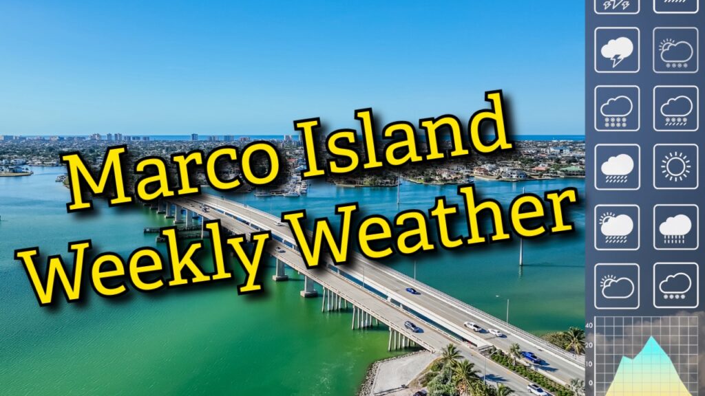
☀️ WEEKLY WEATHER FORECAST
☀️ Sunday, Sept. 13
🌡️ High: 89°F / 32°C
🌡️ Low: 77°F / 25°C
⛈️ Humid with some sun early; thunderstorms possible during the afternoon.
🌤️ Monday, Sept. 14
🌡️ High: 91°F / 33°C
🌡️ Low: 77°F / 25°C
⛈️ Sun and clouds with an isolated afternoon thunderstorm.
⛅ Tuesday, Sept. 15
🌡️ High: 91°F / 33°C
🌡️ Low: 78°F / 26°C
⛈️ Partly sunny, humid, with a couple of afternoon storms.
⛈️ Wednesday, Sept. 16
🌡️ High: 92°F / 33°C
🌡️ Low: 74°F / 24°C
🌧️ A potentially drenching afternoon thunderstorm.
🌤️ Thursday, Sept. 17
🌡️ High: 91°F / 33°C
🌡️ Low: 76°F / 24°C
⛈️ Clouds and sun with an afternoon thunderstorm possible.
⛈️ Friday, Sept. 18
🌡️ High: 91°F / 33°C
🌡️ Low: 75°F / 24°C
🌧️ A couple of afternoon thunderstorms.
☁️ Saturday, Sept. 19
🌡️ High: 88°F / 31°C
🌡️ Low: 74°F / 23°C
🌦️ Mostly cloudy and humid with several showers, especially later in the day.
🌴 Best Outdoor Strategy
Go early.
Morning through early afternoon should usually offer the best combination of lighter winds, lower lightning risk and more comfortable beach conditions.
🌧️ RAIN CHANCES
September remains firmly within Southwest Florida’s thunderstorm season, when abundant moisture and sea-breeze boundaries routinely generate afternoon thunderstorms.
Expect a daily chance of rain or thunderstorms throughout most of the week, with Wednesday through Friday appearing particularly unsettled.
⚡ Remember: if you hear thunder, you’re close enough to be struck by lightning.
🌀 TROPICAL OUTLOOK: 🟢 LOW IMMEDIATE CONCERN
The Atlantic continues through an unusually quiet stretch for this point in the hurricane season.
Recent forecasting indicates Atlantic activity is running exceptionally low, although forecasters continue watching for possible development near the Southeast U.S. coast around mid-September.
NOAA’s updated seasonal outlook continues to favor a below-normal 2026 Atlantic hurricane season overall.
Marco Island Tropical Threat
🟢 No immediate tropical threat highlighted for Southwest Florida in the information reviewed for this report.
September is still climatologically one of the busiest parts of hurricane season, so residents and visitors should continue monitoring forecasts daily.
🌊 MARCO ISLAND TIDES
Big Marco River — NOAA Station #8724991
Sunday, Sept. 13
⬆️ High: 2:52 AM — 3.0 ft
⬇️ Low: 9:12 AM — 0.3 ft
⬆️ High: 3:34 PM — 2.9 ft
⬇️ Low: 9:25 PM — 1.0 ft
Monday, Sept. 14
⬆️ High: 3:21 AM — 3.0 ft
⬇️ Low: 9:55 AM — 0.3 ft
⬆️ High: 4:22 PM — 2.6 ft
⬇️ Low: 9:57 PM — 1.3 ft
Tuesday, Sept. 15
⬆️ High: 3:49 AM — 2.9 ft
⬇️ Low: 10:38 AM — 0.3 ft
⬆️ High: 5:13 PM — 2.4 ft
⬇️ Low: 10:28 PM — 1.5 ft
Wednesday, Sept. 16
⬆️ High: 4:15 AM — 2.8 ft
⬇️ Low: 11:27 AM — 0.5 ft
⬆️ High: 6:15 PM — 2.2 ft
⬇️ Low: 11:01 PM — 1.7 ft
Thursday, Sept. 17
⬆️ High: 4:44 AM — 2.7 ft
⬇️ Low: 12:26 PM — 0.6 ft
⬆️ High: 7:30 PM — 2.1 ft
Friday, Sept. 18
⬆️ High: 5:30 AM — 2.6 ft
⬇️ Low: 1:36 PM — 0.7 ft
⬆️ High: 9:03 PM — 2.0 ft
Saturday, Sept. 19
⬇️ Low: 1:03 AM — 1.9 ft
⬆️ High: 7:05 AM — 2.6 ft
⬇️ Low: 2:50 PM — 0.7 ft
⬆️ High: 11:25 PM — 2.1 ft
Tide predictions are from US Harbors using NOAA Station 8724991. Actual water levels can vary because of wind, atmospheric pressure and thunderstorms.
🌅 SUNRISE / SUNSET
Sunday, Sept. 13
🌅 Sunrise: 7:11 AM
🌇 Sunset: 7:33 PM
Daylight slowly decreases through the week.
Saturday, Sept. 19
🌅 Sunrise: 7:14 AM
🌇 Sunset: 7:26 PM
🎣 FISHING OUTLOOK: ⭐⭐⭐⭐☆ — GOOD
Fishing conditions should be favorable during quieter morning periods.
🎣 Best Opportunities
Snook around passes, mangroves and structure
Redfish along mangrove shorelines
Mangrove snapper near docks and structure
Trout over grass flats
Tarpon remain possible
Sharks along beaches and passes
⏰ Best Strategy
Target the moving tide around sunrise, especially before daytime heating produces thunderstorms.
The larger tidal swings early this week should create stronger current around passes and channels, which can improve feeding activity.
⚠️ Offshore fishermen should keep a close eye on thunderstorm development.
🌬️ AIR QUALITY: 🟢 GOOD
Current Marco Island air quality is reported in the Good range, with very low fine-particle pollution.
PM2.5 was recently measured around 1.2 µg/m³, comfortably within health guidelines.
Air Quality Score: ⭐⭐⭐⭐⭐
Excellent conditions for normal outdoor activity.
🌿 POLLEN & ALLERGY OUTLOOK: 🟢 LOW
Current pollen conditions are rated Low.
🌳 Tree pollen: None/minimal
🌾 Grass pollen: Low
🌿 Weed pollen: None/minimal
Allergy Rating: ⭐⭐⭐⭐☆
Rainfall may temporarily knock airborne pollen concentrations down further, although mold can increase after prolonged humid or wet periods.
🏖️ OVERALL MARCO ISLAND BEACH SCORE
⭐ 8.5 / 10 — VERY GOOD
👍 The Good
🟢 No statewide Karenia brevis detected
🟢 No reported red-tide respiratory irritation
🌊 Extremely warm Gulf water
🏊 Excellent swimming temperatures
🌬️ Generally good air quality
🌿 Low pollen
🚤 Mostly manageable marine conditions early in the week
🎣 Good fishing opportunities
⚠️ Things to Watch
⛈️ Daily afternoon thunderstorms
⚡ Lightning
🌊 Briefly rough water around storms
🌧️ Periods of heavy rain
☀️ High UV and heat/humidity
🏆 BEST BEACH TIME THIS WEEK
🌅 8:00 AM – Noon
Early beach trips should generally offer the week’s best combination of:
🏖️ Calmer conditions
🌊 Smooth Gulf water
🎣 Better fishing
☀️ Sunshine
⚡ Lower thunderstorm risk
🌡️ Slightly less oppressive heat
By afternoon, keep an eye on the inland sky. Southwest Florida thunderstorms can develop quickly.
🌴 Marco Island Naples News Beach Tip
Beach early, hydrate often, use plenty of sunscreen, and don’t try to negotiate with a Florida thunderstorm. The thunderstorm always wins.
Conditions can change quickly. Check current radar, lightning information, beach flags and official marine forecasts before swimming or boating.
Marco Island Water Temp & Surf Conditions
Marine & Surf Forecast
Florida Red Tide — Current Status
Live sampling map from the Florida Fish & Wildlife Conservation Commission (FWC)
Reading the Dots
For the full written weekly status report and regional PDFs, see FWC's Red Tide Current Status page.
This article is brought to you in part by our sponsors